By Paula Ayotte
PIFSC scientists have been assessing and monitoring the coral reef ecosystems at islands and atolls in the central and western Pacific since 2000. The PIFSC Coral Reef Ecosystem (CRED) now is establishing baselines and initiating capacity building of local institutions in the Coral Triangle region to monitor their coral reef ecosystems. We are leveraging our experience and some of the methods and tools honed during NOAA research expeditions to Guam, the Commonwealth of the Northern Mariana Islands, American Samoa, the Hawaiian Archipelago, and the Pacific Remote Island Areas as part of our Pacific Reef Assessment and Monitoring Program (Pacific RAMP), but this work in Timor-Leste requires us to do some things a little differently.

This photo, taken on June 6, shows the diversity of a typical reef scene in Timor-Leste. NOAA photo by Paula Ayotte
The combined fish-survey experience of the CRED divers taking part in our current Timor-Leste mission is more than 20 years. Some of us on this current expedition have worked together to conduct fish surveys on CRED research cruises since 2005. We’re accustomed to operating as a well-honed machine, with the 68-m NOAA Ships Hi`ialakai and Oscar Elton Sette as our base, for our typical 3-month missions. We’re used to getting into a daily routine of launching small boats, heading out into the blue to various dive sites around familiar islands, and returning back to the ship in the afternoon to clean up, eat dinner, enter data, and head off to bed. Our current land-based operation off the coast of Timor-Leste has required changes to our normal routine.
Normally, to get to the archipelago where we are to conduct surveys, we board a NOAA ship in Honolulu and then the vessel transits for a period of anywhere from a day to more than a week to our destination. We’re able to effectively use that transit time to prep gear, study unfamiliar fishes, go through safety drills, and whatever other necessary chores need to be done. No jet lag is involved. In contrast, our trip to Timor-Leste took 3 flights and more than 20 hours in the air, and we crossed the international date line and 5 time zones. We had a couple of days to adjust before we started our in-the-water survey work, but our first 2 days were busy as we inventoried and prepped gear, attended meetings with officials from local agencies, including Timor-Leste’s Secretary of State for Fisheries, and brushed up on the new fishes we know we’re likely to see here.

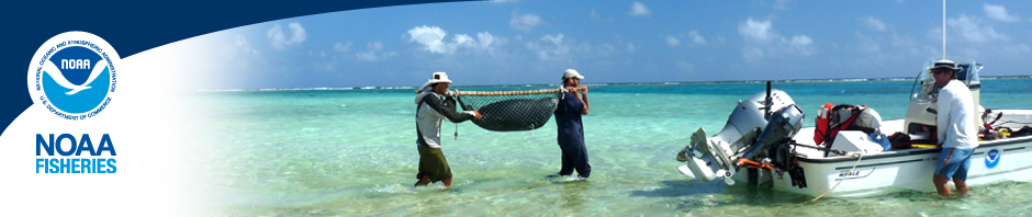
Brett Schumacher, Paula Ayotte, and Andrew Gray of the PIFSC Coral Reef Ecosystem Division on June 4 load a small boat at Dili Harbor as they start Day 1 of fish and benthic surveys at Timor-Leste. NOAA photo by Kaylyn McCoy
Dive day 1. On June 4 (June 5 in Honolulu), we woke up extra early to load our gear into a truck and head over to Dili Harbor to meet up with Rob Crean, who works at a local dive company, Compass Charters, and serves as the captain of the small boat, Lancet, that we are using to conduct surveys. There was no dock at the harbor; instead, a small boat pulled up to the beach, so we waded into the water carrying our gear and pushed off the sand to make the short ride to the Lancet and transfer our equipment. Once onboard, we had a safety briefing and then motored to our first site, heading east. Once at the first site, the first team—Brett Schumacher and Kevin Lino—geared up and jumped into the water to do our first fish and benthic surveys in Timor-Leste. This work essentially is the first time fish populations have been measured so extensively here. We hope to survey almost 150 sites along the northern coast using an established method that allows us to simultaneously collect data on the density and size distribution of the entire fish community at each site at the species level, especially targeted fishes, such as sharks, snappers, jacks, and groupers.

Andrew Gray on June 5 conducts a stationary-point-count survey of reef fishes at a dive site in the waters near Dili, the capital of Timor-Leste. NOAA photo by Kevin Lino
The survey method we are using during this mission is the stationary point count (SPC), the same method that we have used during Pacific RAMP cruises. An SPC survey involves laying out a 30-m transect line that 2 divers position themselves along so that each diver is at the center of an imaginary, visually estimated cylinder 15 m in diameter. The divers identify, count, and size the fishes that enter into their respective cylinders (for more information on the SPC method, please see this PIFSC Administrative Report: Ayotte et al. 2011). After they survey for fishes, the divers complete visual estimates of the bottom habitat of their cylinder area, quickly assessing how much is made of hard corals, algae, sand, calcifying algae, turf algae, or soft corals. The combination of this data with the fish data allows us to better understand how and where fishes use various habitats and to help answer questions, such as whether there are more fishes at sites where there is more coral cover or if different kinds of fishes are associated with areas with more macroalgae. Photos of the bottom substrate also are taken along the transect line to be analyzed later to provide a more detailed assessment of the benthic habitat.

Kaylyn McCoy and Andrew Gray on June 9 prepare the mapping tool to take depth readings between dives at a site near Liquiçá. NOAA photo by Paula Ayotte
While the first team was underwater at the first survey site, the rest of us were up top in the Lancet, prepping gear for the next dive and setting up the mapping tool, which is designed to constantly record depth information as we slowly motor around a dive site. Because we were working off one boat, we took turns diving. Later, during the live–aboard portion of this mission, we’ll split into 2 teams working off 2 separate small boats, and we’ll be able to double the number of sites we visit.

The speckled damselfish (Pomacentrus bankanensis), captured in this photo taken on June 9, is one of the many damselfish species found at Timor-Leste. NOAA photo by Paula Ayotte
When Lino and Schumacher surfaced and exited the water, they were eager to share what they saw on their dive. They relayed that, although there weren’t many large fishes (>30 cm in length), there were lots and lots of smaller fishes, especially damselfishes. Timor-Leste, as part of the Coral Triangle region, is known for having a high diversity of marine life—double or triple the number of fish species we normally encounter at the other island chains that we survey. As we heard about the variety of species that the first team observed, at that moment, we were glad that we had done our homework and tested ourselves on the fishes that have been catalogued here before. Schumacher and Lino added that the visibility wasn’t great and that they had seen many soft corals and some moderate-sized fishes that we don’t see often—rabbitfishes and breams. On the next dive, the visibility improved and the habitat had more rocks and boulders with less corals, but there were still lots of small fishes and other fishes that were new to us.

Kaylyn McCoy and Paula Ayotte process water samples, which later will be analyzed for dissolved inorganic carbon, while Captain Rob Crean keeps an eye on ocean conditions between dives at Atauro Island on June 6. NOAA photo by Andrew Gray
During surveys on following days, we got more and more comfortable with the changing conditions and the amazing assortment of fishes and fell into somewhat of a routine: load our gear into the Lancet, motor to our dive sites, conduct our surveys and map the area, come back to rinse our gear and have dinner, and enter our data into a database. On our third day of diving, we motored to Atauro Island, where we added a water sampling routine into our daily tasks. We had checked out of our hotel and stayed the night on Atauro Island the night of June 6 before returning to Dili on June 7.
On June 8, we met with local partners for Coral Triangle Day and caught up on data entry duties and prepared to move west to Caimeo Beach, where we stayed in tents at the Black Rock Resort for the next 4 nights to conduct surveys around Liquiçá. Joining us at Black Rock were our colleagues from the Timor-Leste Ministry of Agriculture and Fisheries (MAF) and the Coral Triangle Support Partnership (CTSP), who observe our daily operations to get a feel and understanding of what is involved in collecting fish and benthic data and water samples. The MAF and CTSP partners learned how to download data from a subsurface temperature recorder—an instrument used to record temperature and pressure—and they also practiced making water collections from shore. Later, Rui Pinto of CTSP led them in practice of fish and benthic surveys from shore while the CRED team was out conducting surveys on the Lancet. The hope is that our local partners in Timor-Leste, armed with these new skills, will be able to continue the work that we’ve started here. On June 12, almost 20 members of the Liquiçá MAF went to Black Rock to meet with us after a day of diving. They got a rundown of what we’ve been doing and what kind of data we’ll be able to share with them. They expressed great interest in being able to carry on surveys of their fish and benthic communities, combining knowledge from local fishers with the techniques that we’ve demonstrated.

The semicircle angelfish (Pomacanthus semicirculatus), seen here in a photo taken on June 7, is one of the angelfish species found on reefs in Timor-Leste. NOAA photo by Kevin Lino

Kaylyn McCoy and Kevin Lino on June 11 show their excitement about doing fish and benthic surveys at Liquiçá. NOAA photo by Paula Ayotte
Our first week in Timor-Leste definitely was a change of pace for us. We met and worked with local partners, added many new fish species to our knowledge base, and added water sampling and mapping to our individual repertoires. It has been an exciting and challenging experience so far. It also has been rewarding: we were completed 50 fish and benthic surveys at Dili, Atauro Island, and Liquiçá and successfully collected water samples at 2 sites at Atauro Island. We know the work we do is vital. Reef fishes are important to the function of coral reef ecosystems and economically important to local communities, such as those of Timor-Leste, and they can be significant indicators of ecosystem decline and overexploitation. The baseline surveys we are doing during this mission will help to quantify fish populations off northern Timor-Leste and may be crucial in informing direct management actions to preserve the coastal environment of Timor-Leste.
Next on the agenda: on June 13, we boarded the live-aboard catamaran Sundancer, which is serving as our floating base of operations for the second and third weeks of our mission. Working from the Sundancer is allowing us to cover more than 160 km of the northern coastline of Timor-Leste and to continue our surveying of reef fish and benthic communities, water sampling, and mapping at the districts of Oecussi, Bobonaro, Manatuto, Baucau, and Lautem, as well as the west side of Atauro Island.
Watch this space for more updates on this mission in Timor-Leste.


Pingback: Update from Timor-Leste: scientists complete live-aboard mission to survey reef fishes and benthos, assess ocean acidification | NOAA Pacific Islands Fisheries Science Center Blog
Pingback: The final count: summary of mission to assess reef fish assemblages, build capacity in Timor-Leste | NOAA Pacific Islands Fisheries Science Center Blog